Paradise is not where you go but how you feel for one moment of your life.
Anonymous
For years I have driven turn again highway and looked up at the ridge between Bird and girdwood, and thought I bet that would be incredible biking across that ridge. I never pursued it as how to get a bike up there three to four thousand feet (900-2300 meters)above the highway. A few years ago my friend Zak said he had skied Penguin peak and I asked where that was. He mentioned the peak just above the town of Bird, a few miles south of Anchorage. It fell into the category of the new generation skiing stuff my generation never thought of, but new people have pushed onward to new areas. I find it awesome to see new explorations. A friend Brandon mentioned it was possible because of the earlier explorations done. I took that as a complement.
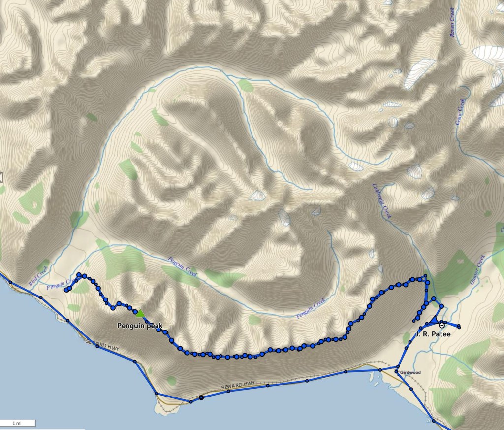
Then I discover there is an actual trail going from Bird, up Penguin Peak and on the ridge toward Girdwood. Wow, that is the area I had envisioned bike riding earlier. Turns out, it is a trail 16 miles( 25+ kilometer) long and not necessarily a bike riding as involves scrambling on rough rock and a steep ascent and descent. OK, but over the past years this body has gotten a bit out of shape, older, fatter and consequently uglier, but this summer has seen major improvements in health. Hence I mentioned the trip to Brandon, who said let’s do it. Hmm Uh oh, be careful what you wish for. I demurred for a bit this summer but really wanted to do it, so felt it was time. But weather is critical and it has been rainy a lot this summer. Finally a weather window. As another friend once said, ” If you don’t do it this year, you will be another year older, next year”.
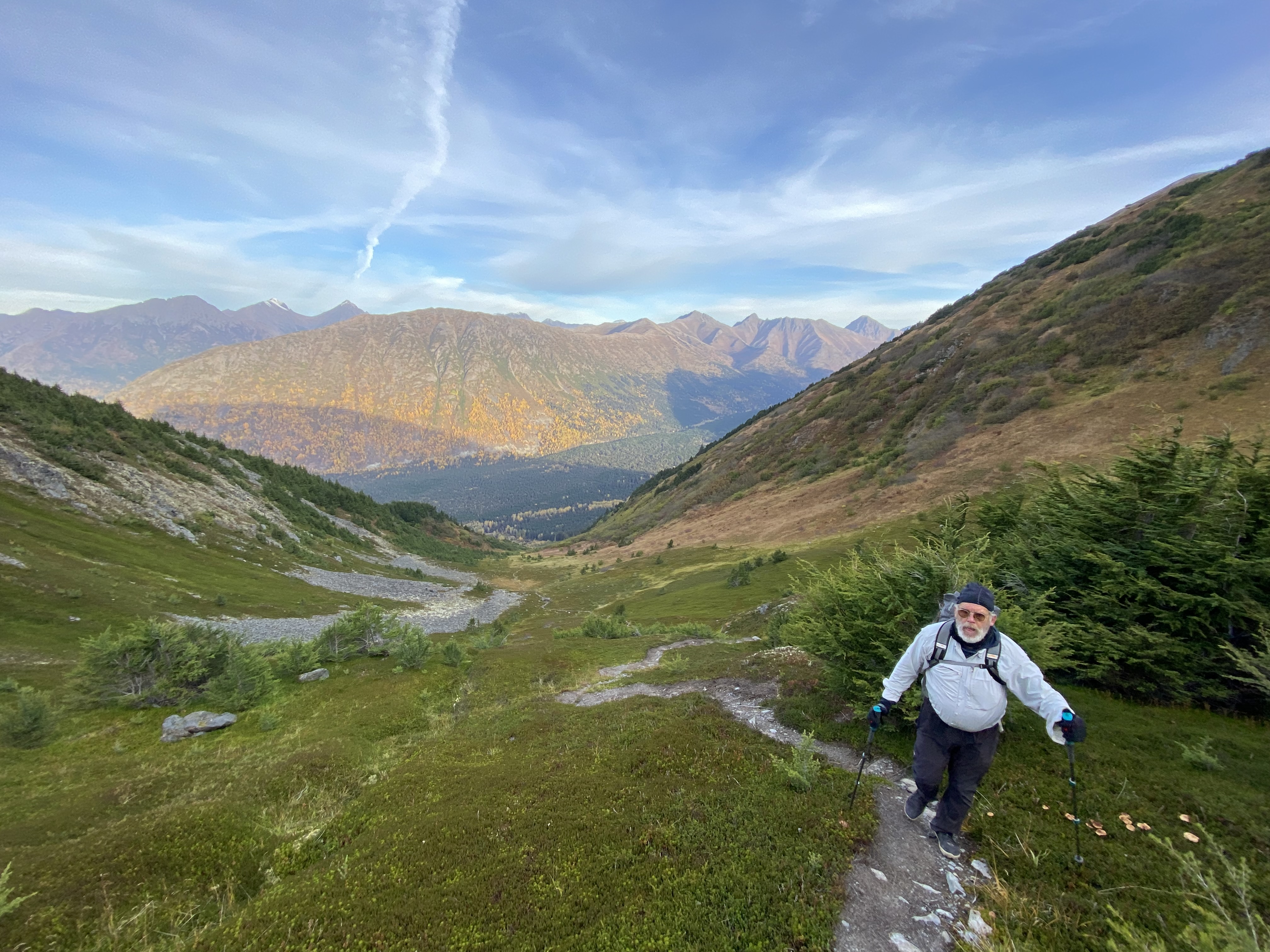
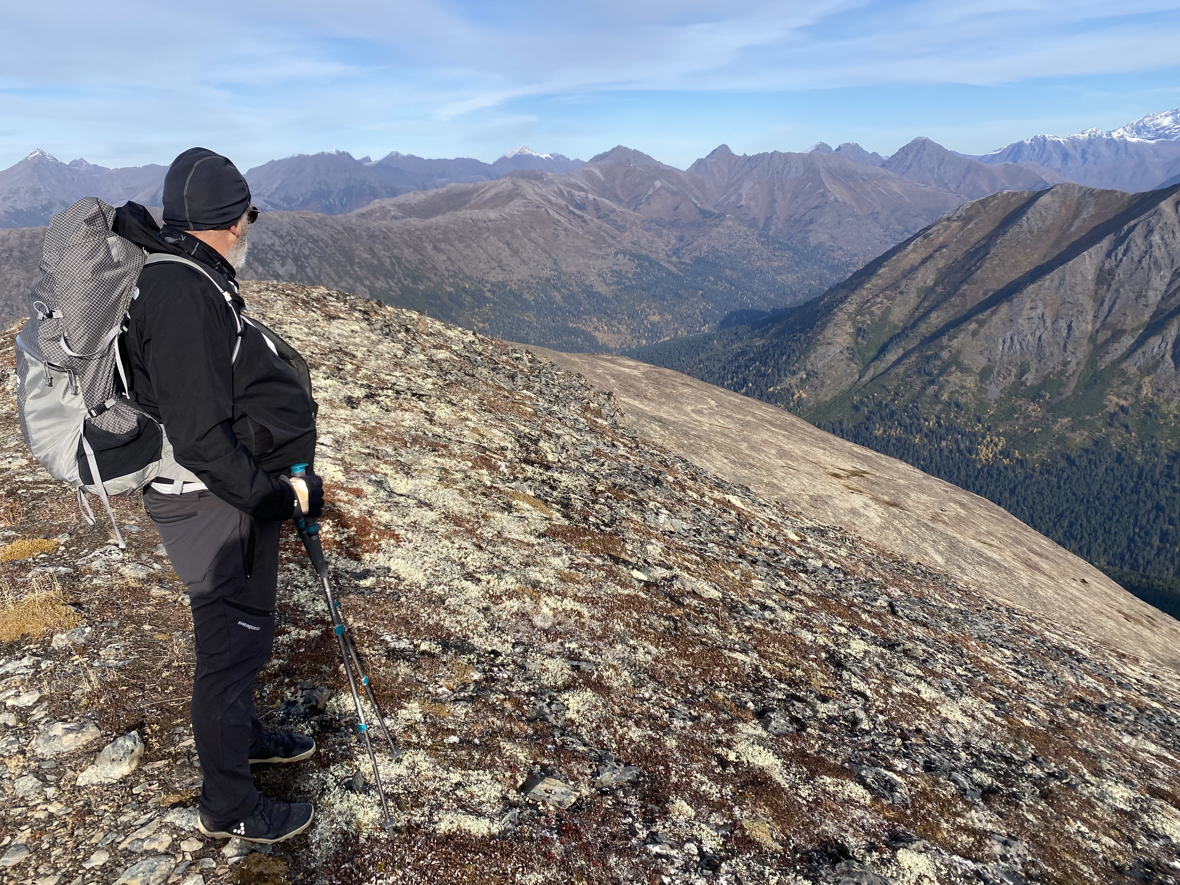
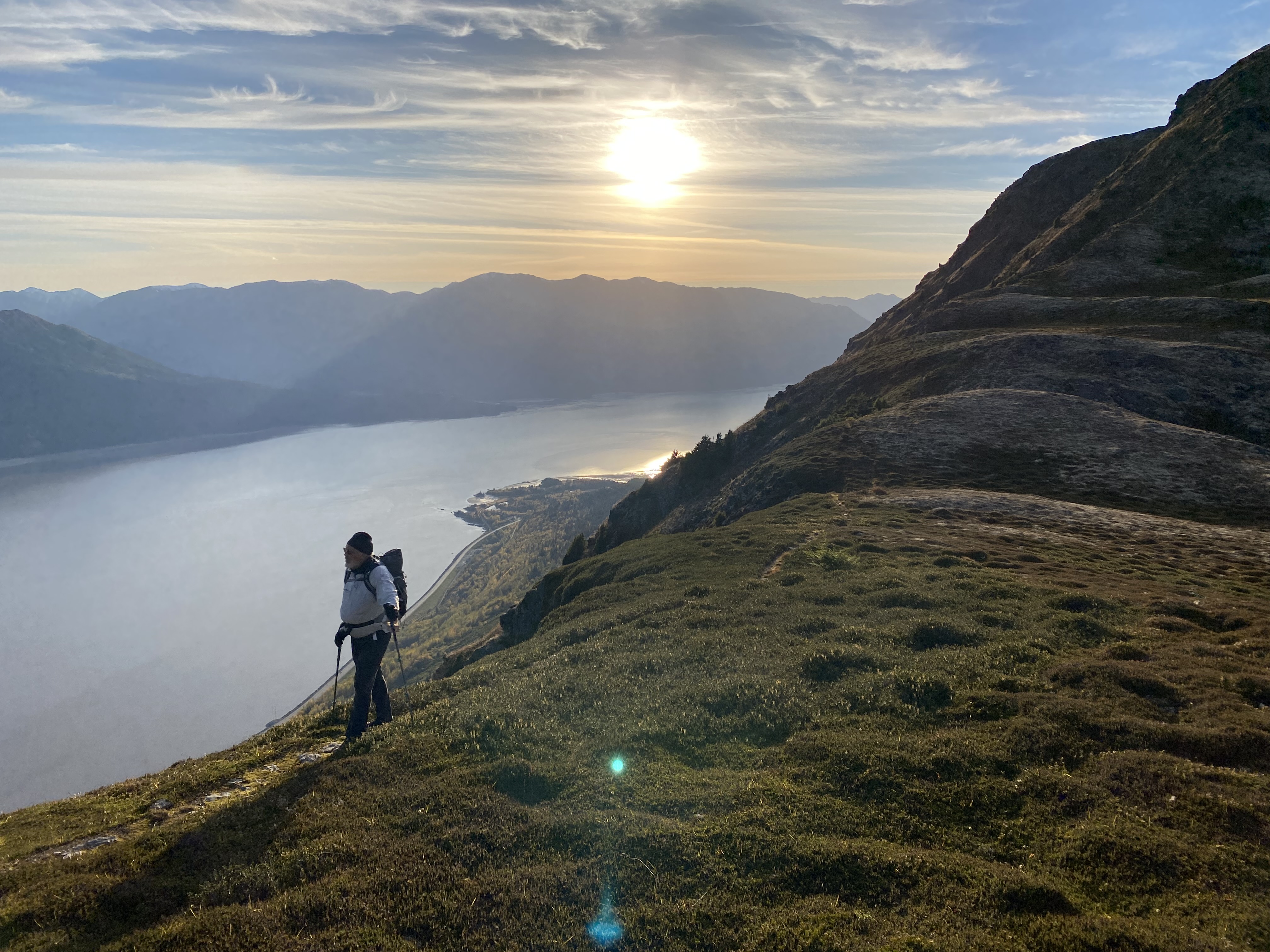
I heard but ignored the questions of friends about the difficulty, but I have done long hikes before. Just one foot in front of the other. Right? What could go wrong? Brandon said he normally does it in about 8 hours. Hmm that seems fast for 16 miles and 7-8 thousand feet of elevation gain, but Brandon is an exerciser. I figure maybe 12 for us, and he is excited for another trip on this trail and I am excited for this trail. I did mention it was a concern of mine that I would be too slow for him. We said no problem. We found a weather window and agreed on an early start, departing 6 am from Anchorage and are at the trailhead at 7 departing headlamps ablaze, before sunrise at 8 am. We did not drop a car for shuttle in Girdwood as weren’t really sure we would succeed and could bail at first peak, if it looked like it would not happen. There are no other exit points along the route. Penguin peak is about 4 miles from the beginning.
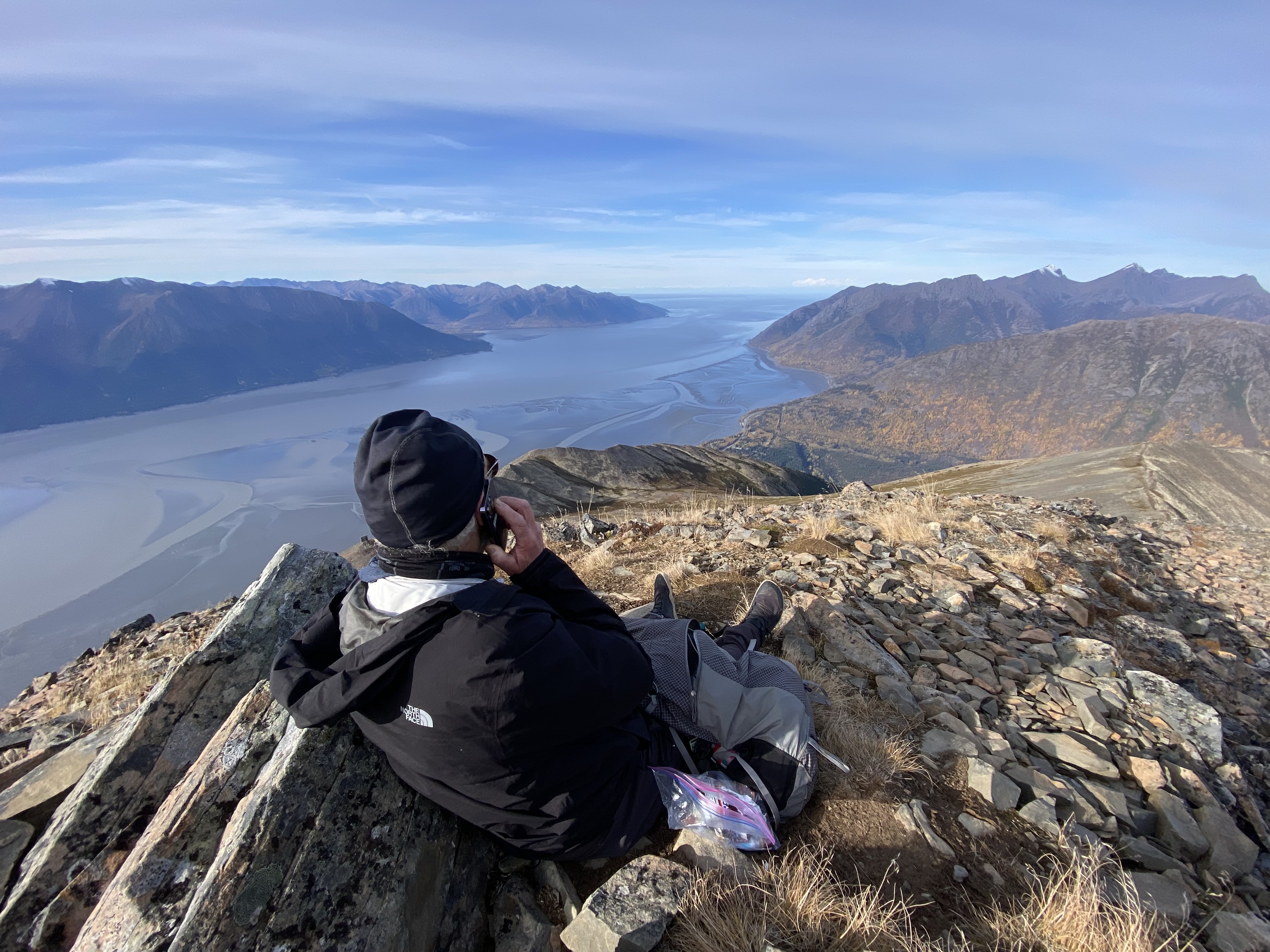
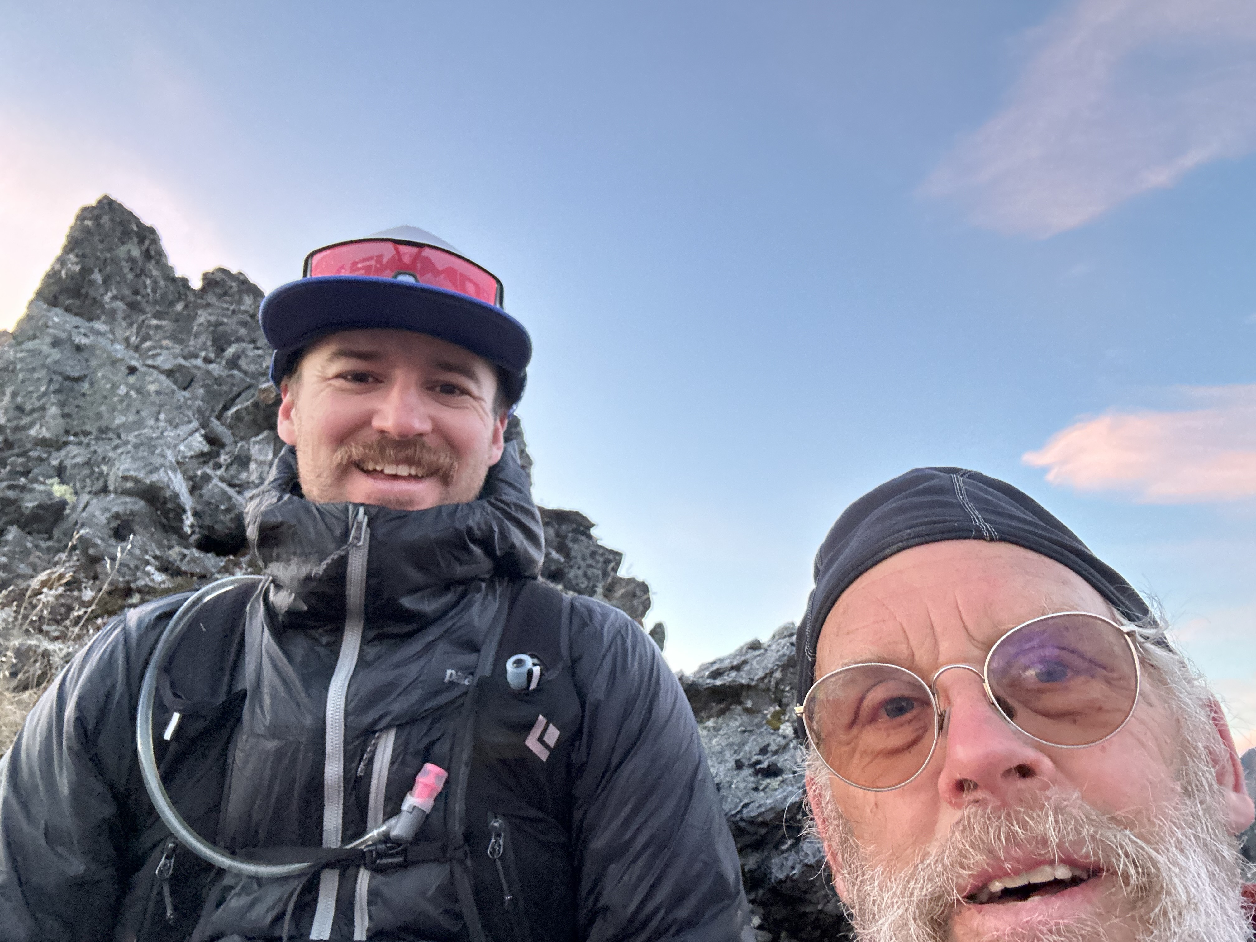
OK all good and at the first summit, Penguin peak, I called our friend, Zak and informed him I felt great and we were going for it. He agreed to come pick us up in Girdwood, and I said probably late about 8pm.
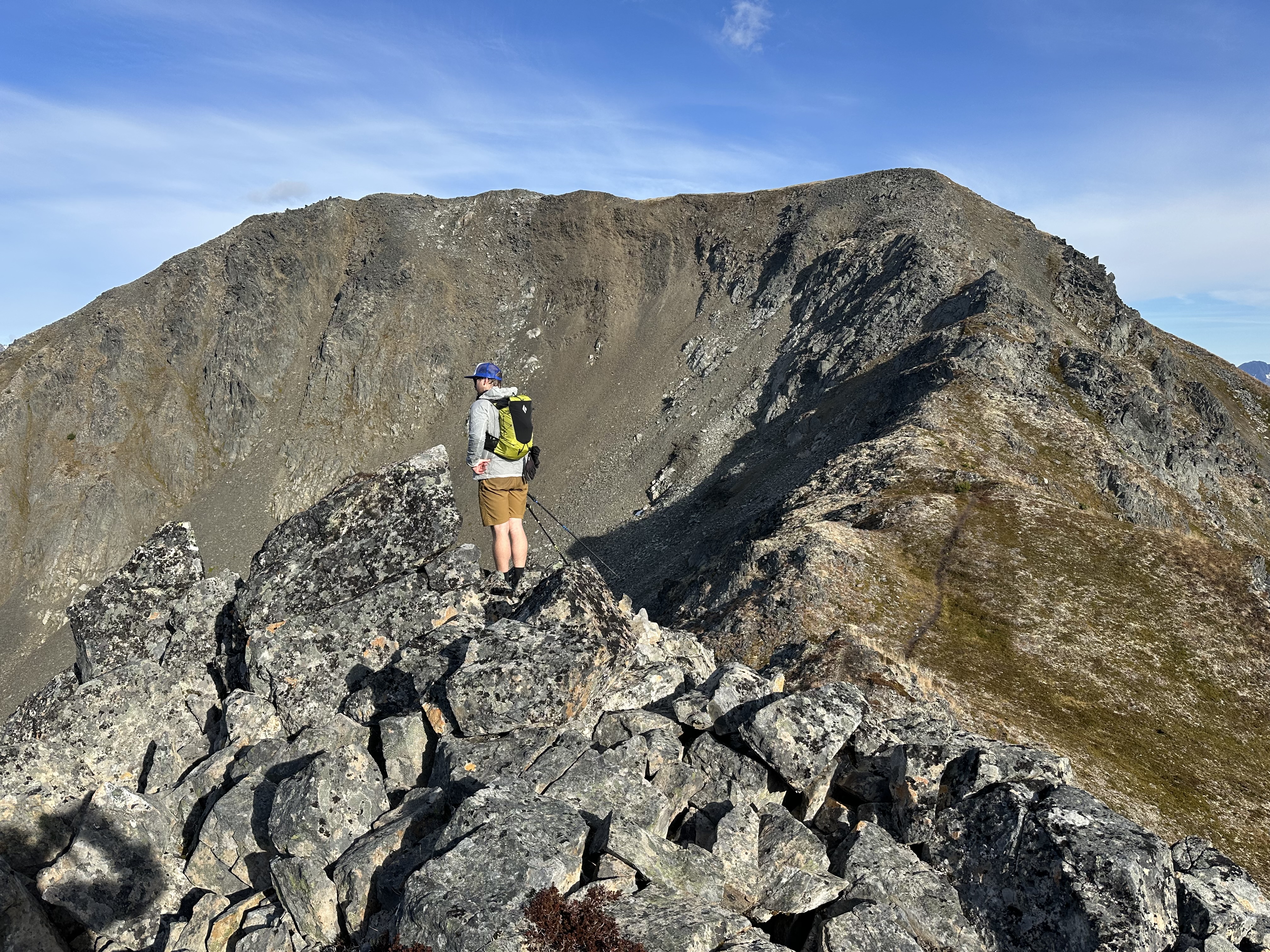
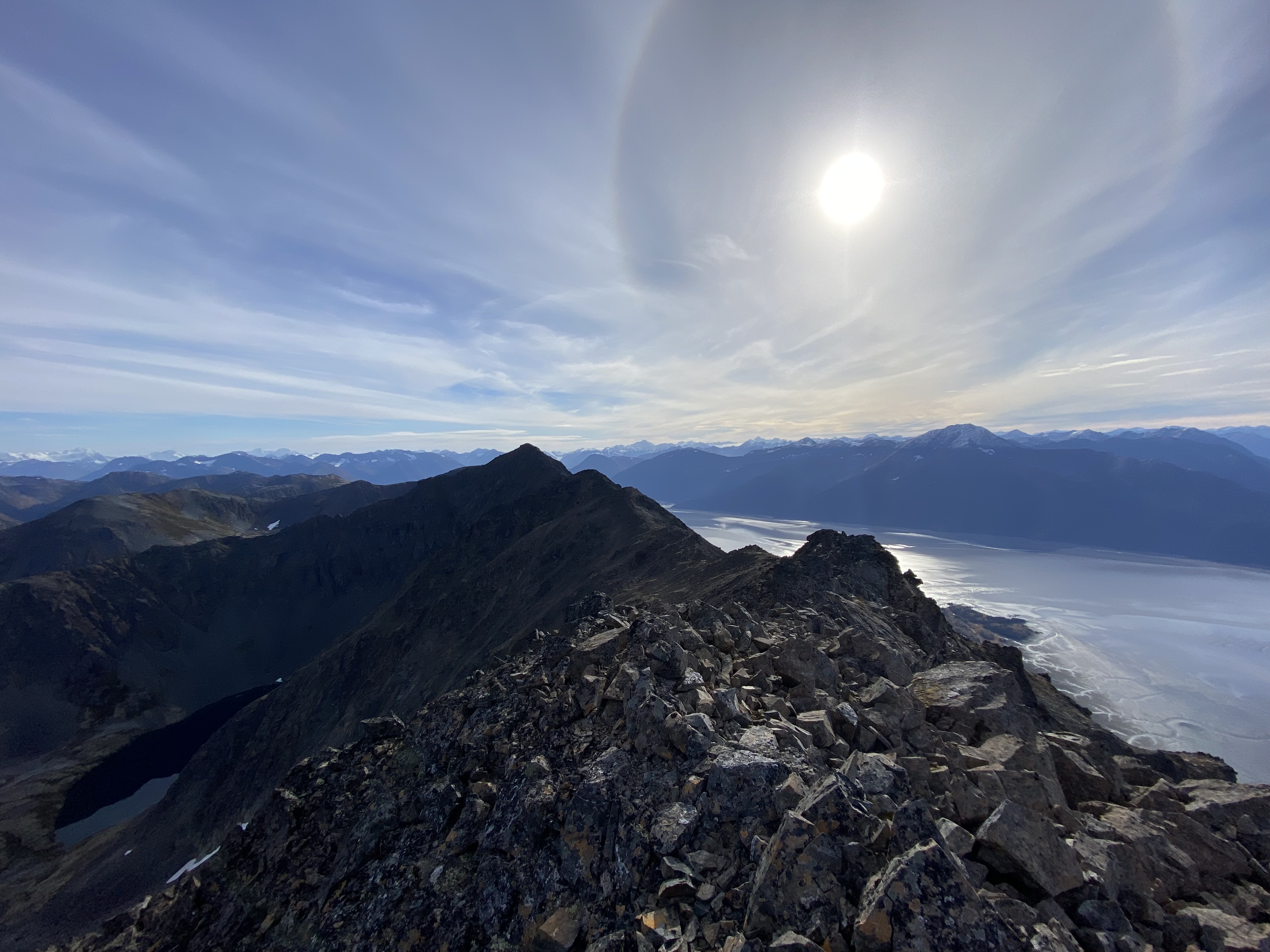
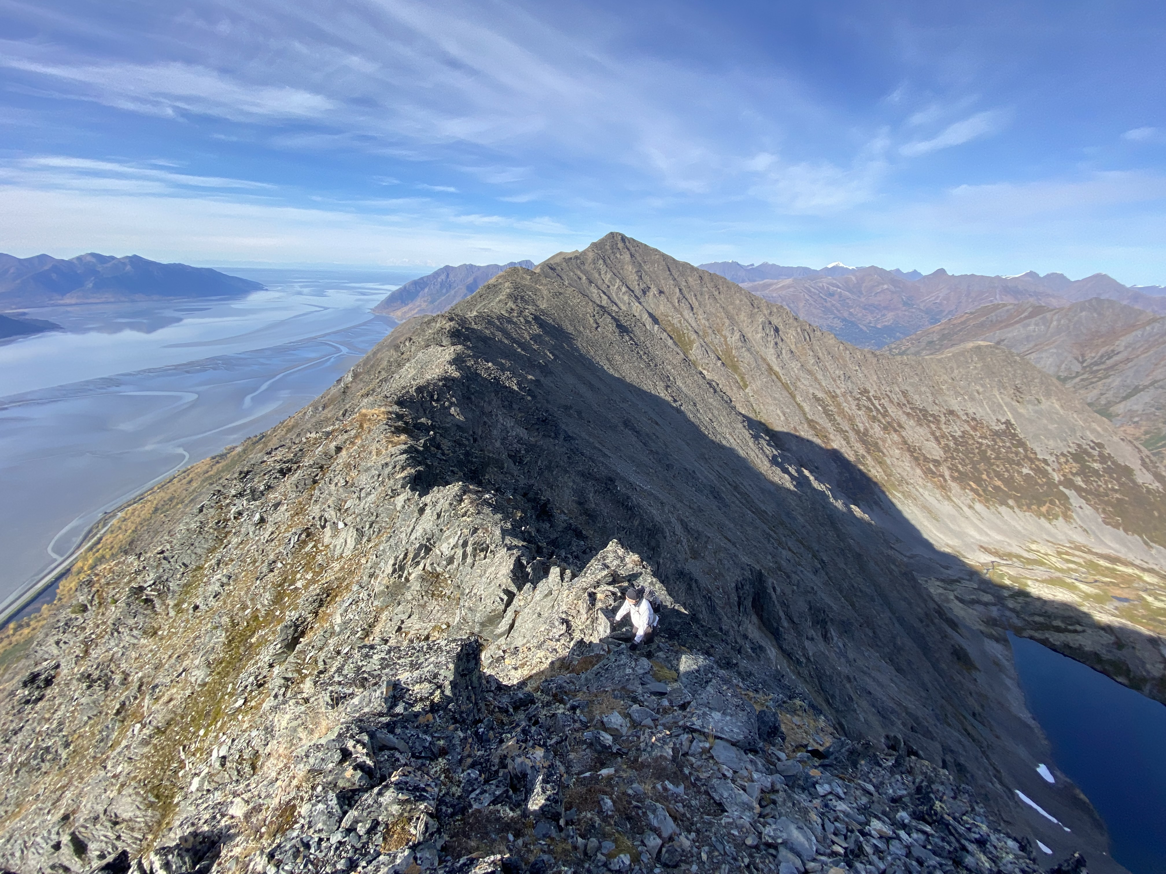
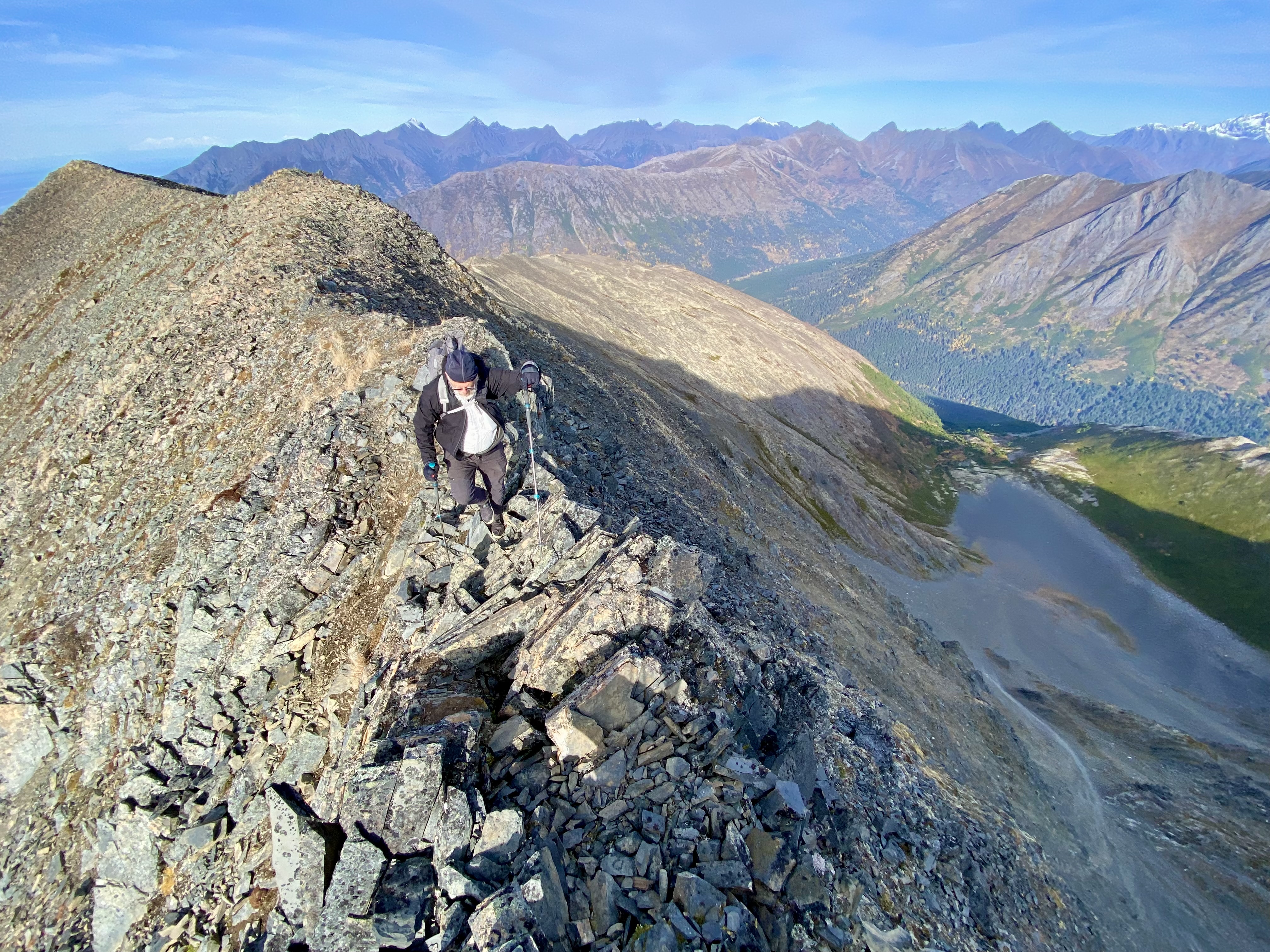
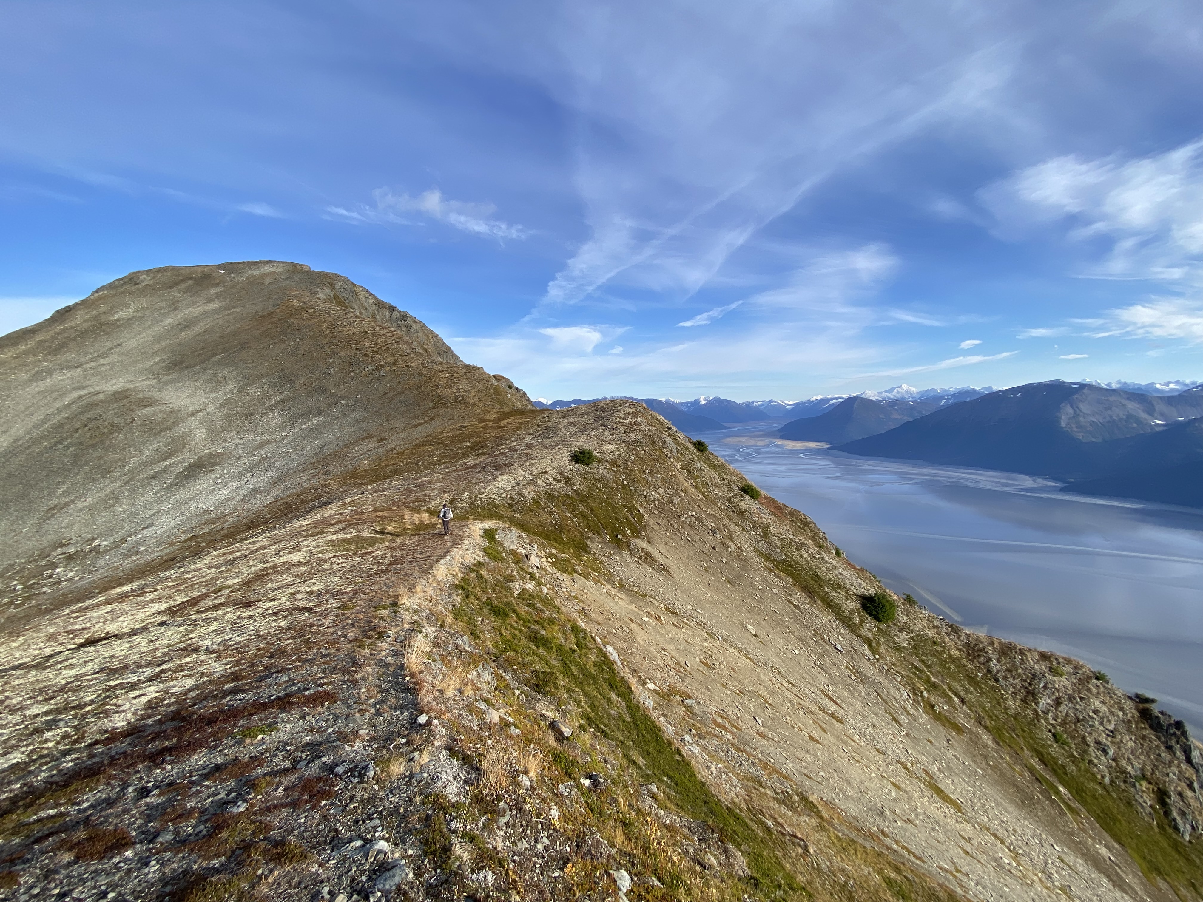
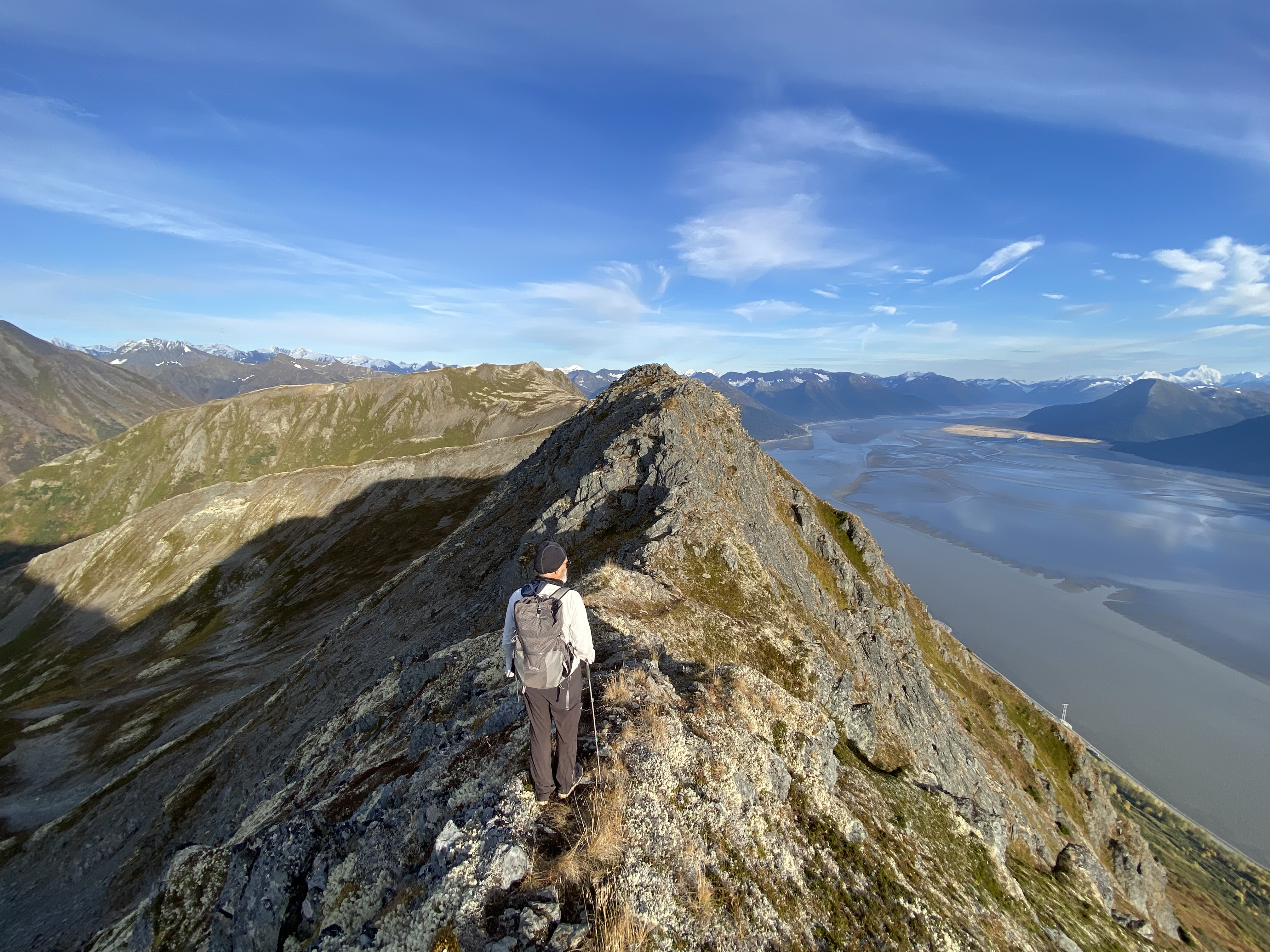
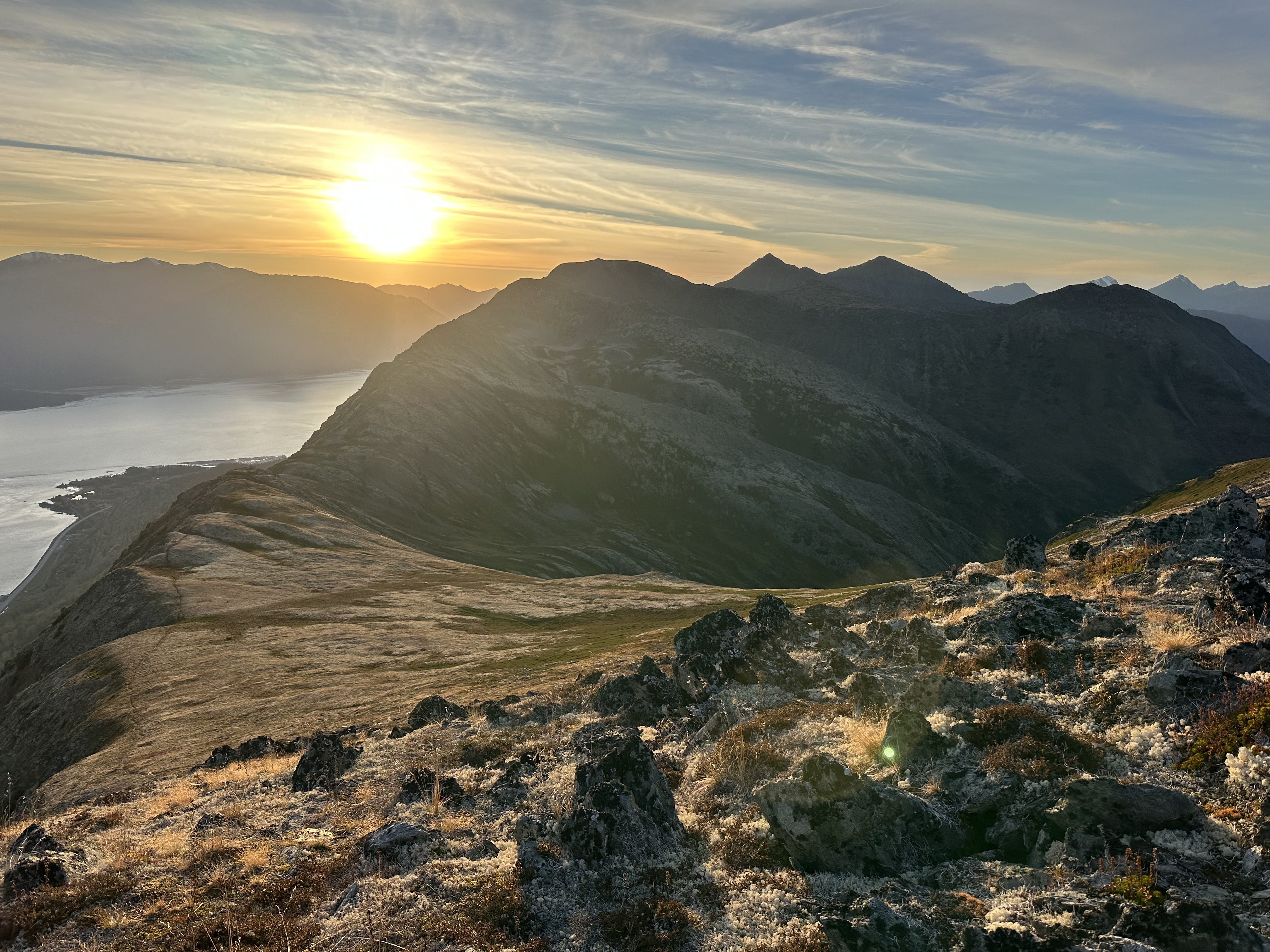
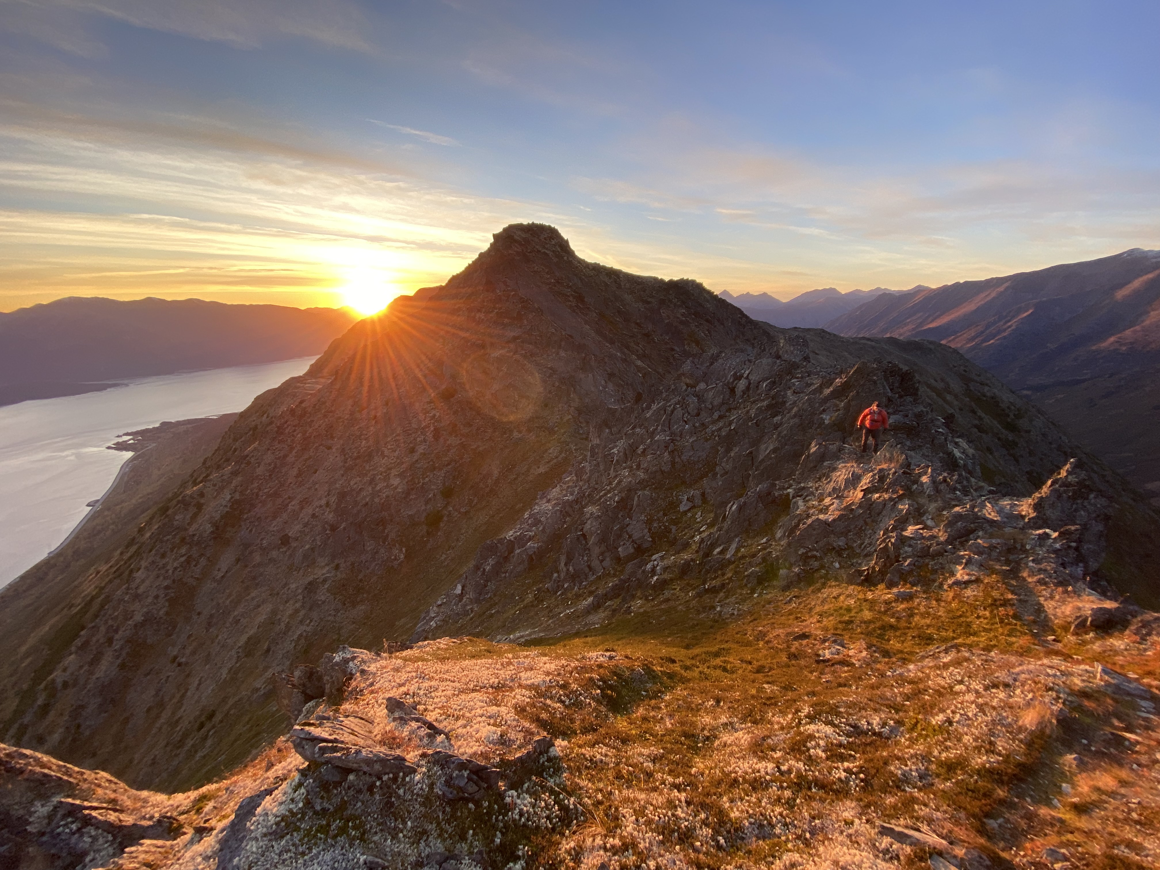
And so the complete trek began. The ridge traverse is a series of peaks one must traverse with big dips in between, I believe it is 500foot decrease in elevation between peak for the minimum requirement to make a separate peak. Hence a lot of up and down. We lost count at 7-8 but I think final count was around 12, although as noted my brain could not do the calculations or remember. It was a lot and quite disheartening when arriving at the summit to think this might be the last one before the last one, before descending the last one outside Girdwood. One would climb up and see more beyond of the thin ridge with rock, instead of the hoped for tundra with soft moss to walk on. Alas I had read the reports and what I heard was some scrambling on rock, thinking that meant a fair amount of tundra, which I had imagined when first thinking of the route. Just because you think it does not make it true.
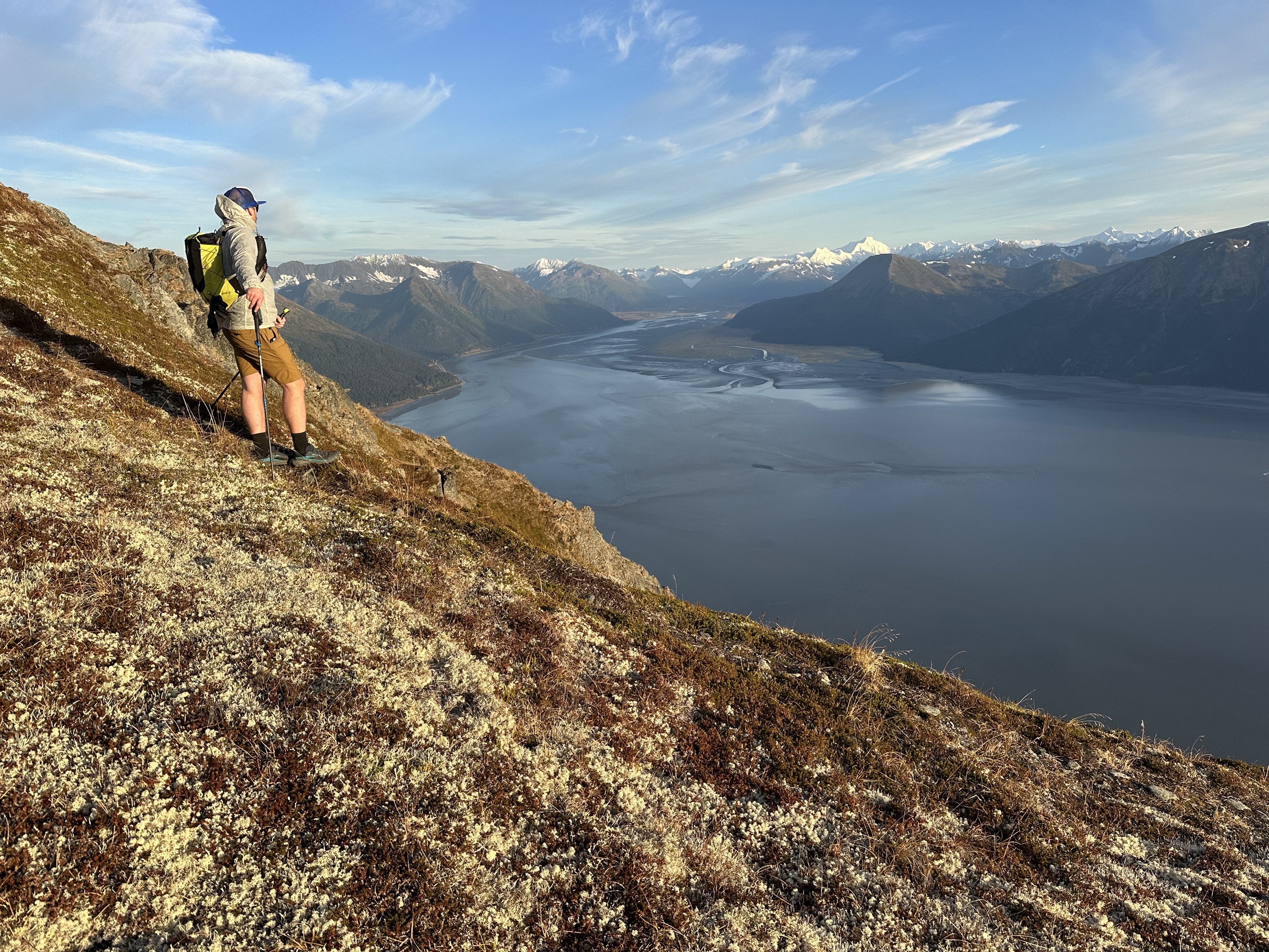
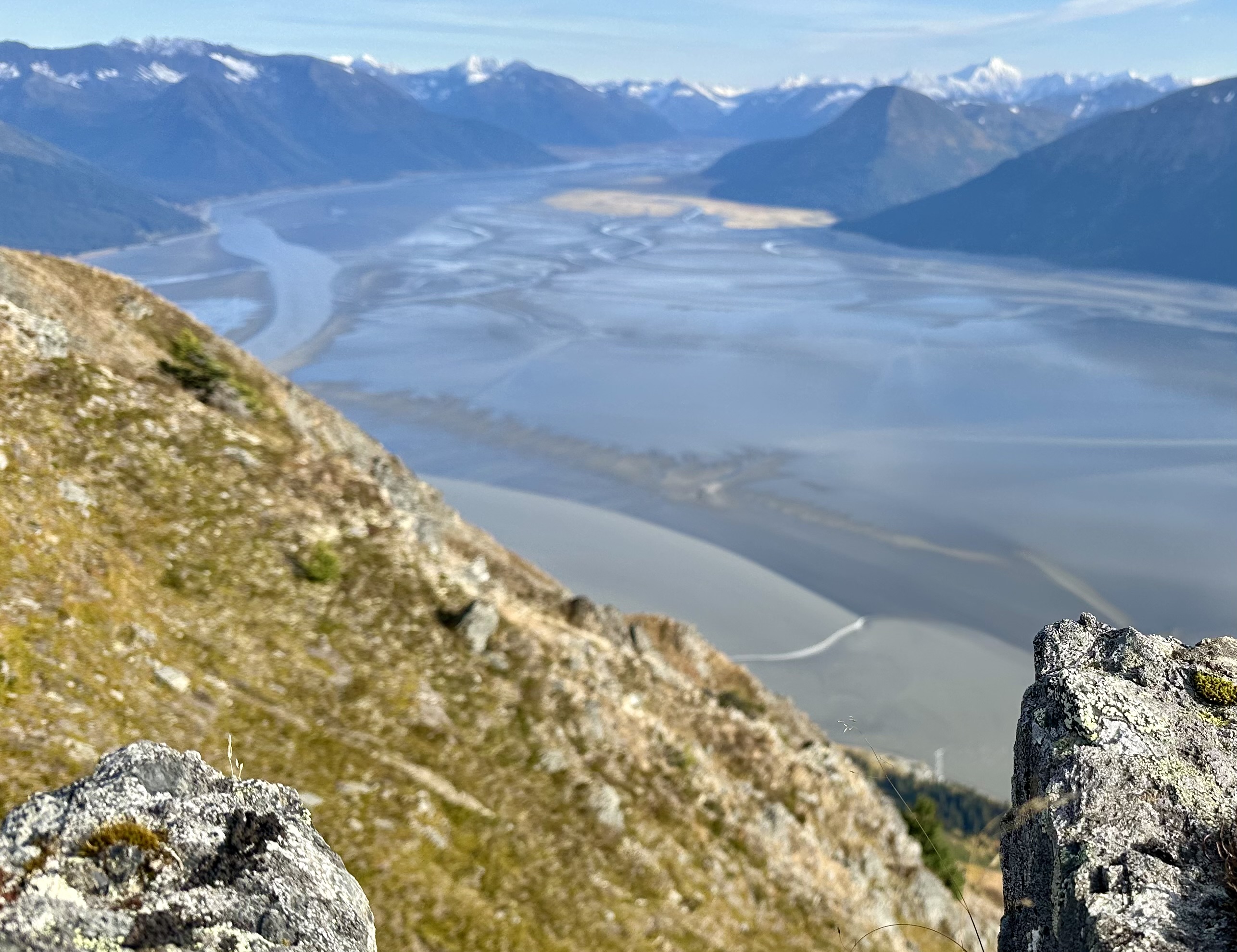
And concerning the rock there was a lot, which OK the Chugach mountains are made of rock, and not very good rock. This is a hodgepodge of boulders, and rock requiring sometimes finesse to move around. Every step must be carefully calculated, because a loose rock could mean an injury or worse. Especially when some of those steps involve a high degree of exposure. It sometimes fell away thousands of feet, although usually anything involving a fall of over 20 feet is irrelevant of the distance. It can and probably will hurt. The view throughout the day were spectacular with mountains, lakes, valleys, glaciers, birds and planes flying below, as well as the turnagain inlet highway nearly seemingly straight below us. To admire the view one is required to stop and look- no walking and looking around at same time. Often Alaska trails are this, trails are more a suggested guideline rather than an actual trail carved out.
As the day wore on we began to realize it was taking us a long time. We had told Zak finish maybe 8 pm 13 hours after the start. It was beginning to get late in the day and we were barely half way. Looked like we were going to need headlamps again that night. But our mood was good, not a complaint between us. We were laughing although the chit chat on the first hours was definitely diminished. We took an occasional break to refuel and water and admire views, but never extended stops. We had a purpose. Brandon was an awesome partner never once did he mention my obvious slower than his usual pace, always set a good pace for me and we checked on each other frequently. ” How is your physical battery doing?”. At this point my “battery level was about 4/10, much lower than I would like, but we both knew the only way out was to walk and finish the route, one step at a time. Complaining about it was not going to help, so we laughed.
Later in the day my mind though was full of thoughts. Why had I gotten us here. What business did I have getting us into this. I thought of escape routes but we nixed the only possibility, descending to the road.
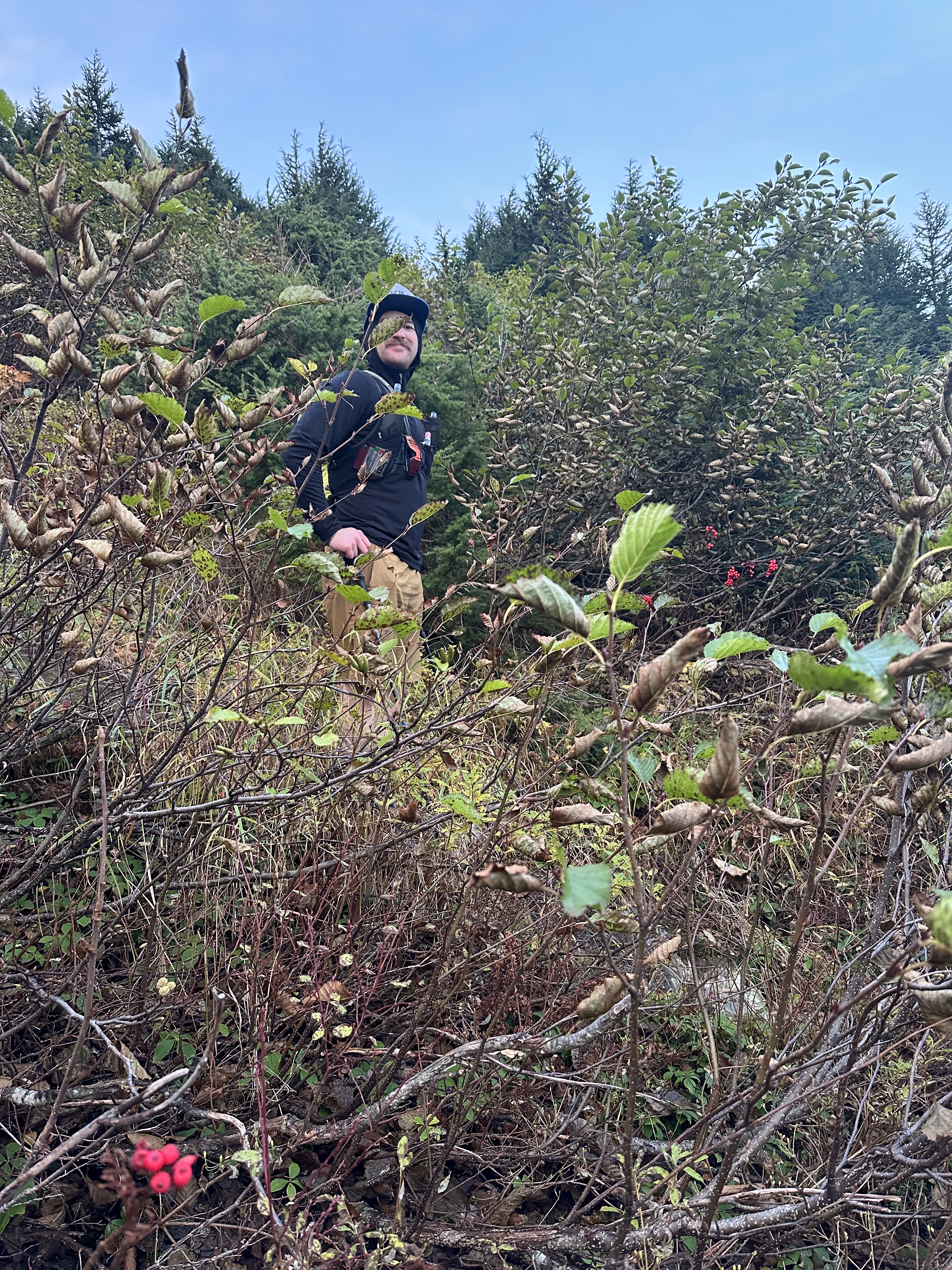
That idea of descending was quickly eliminated due to we knew there were a lot of cliffs down there we could not see, and below that was hundreds of yards of thick Alder, the bane of hikers. Alaska’s version of hell. Alder bashing is incredibly frustrating with every thing getting tangled in the thick brush, of which bears can get through, hidden. A bore tide of medium height came through and we watched the tidal bore wave come up the inlet as the tide came in.

Sunset came and went and we were hiking in the dark. Luckily we were past the technical scrambling sections so no scary climbs or worse down climbs in the dark, but you still had to watch your steps.
Headlamps on and several peaks yet to go. for some reason I kept thinking “when we get to the top it will be a somewhat flat tundra and we can walk on very soft moss and lichen.” Once again my brain tried to create things that were not. Or I would say this is the last peak and we will begin curving along the girdwood valley and begin descending. Alas that was not to be until far later in the night and several peaks later.
8 o’clock passed and we were not even remotely close, and no cell reception to call Zak, although we knew he was tracking us via the in reach. Finally about 9 we had enough cell signal to text message and say it was going to be very late and we would try and find a cab, Uber or Lyft ride, which would have to come from Anchorage. He replied no worries he would still come get us. We trudged onward as the magnificent skies opened to thousand and thousands of stars, the big dipper now guiding us north, with the lights of girdwood valley below us, but alas our headlamps only showed what was ahead and not the peaks we needed to climb. The ground although still rough and with lots of ridges was not forthcoming in its exact layout. Our maps were of not enough detail to find the 50-75 foot variations leading off in various directions. It was about 1:30 when I called Zak and said we were still high up on the ridge and having difficulty finding the descent route. He said he would drive down see if he could see our headlamps and somewhat guide us in.
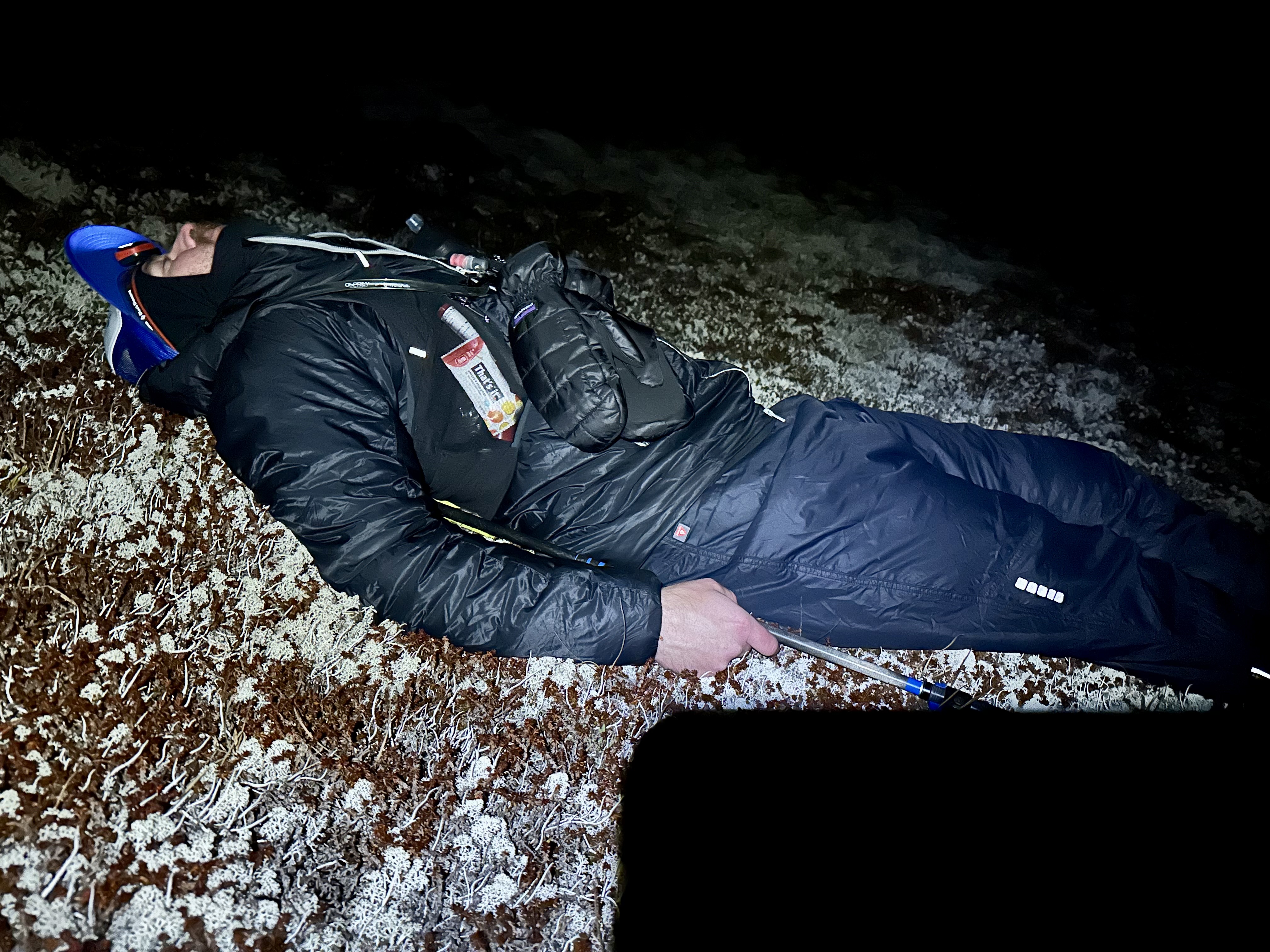
At 2 Brandon suggested a quick 2-3 minute dirt nap just to revitalize a bit. We laid down and maybe not sleep but rested. A too welcome relief. We had emergency bivouac gear but it would not have been the least bit comfortable and more likely miserable. The temps were now below freezing, and although we were plenty warm, and had gear for hiking it was limited for overnight. That idea of bivouacing was also short-lived. Onward we trudged again thinking the descent was sooner than it really was. To descend too early meant severe alder bashing, although we were pretty sure the cliffs were gone, now.
We chose to sidehill instead of going up and over another peak, which led us to somewhat descend, which was OK. We were ready to get down.
About 2:30 Zak had arrived, but it was totally hopeless and not a consideration to see our headlamps. We were now in either a hemlock forest, tall grass, with service berry bushes, devils club or in alders. Brandon would head off a bit to see if he could find a clear route, which left me alone to figure out what? I called Zak to update him and he texted a picture of a different map with a trail on it. We determined our position via the inreach GPS, and determined the trail was a ways to the north. I had been telling Zak my gps said we were at 600 feet but he said the tracker was saying we were at 2000 feet. A psychological setback. I checked another map and it read 2000 feet, I think the first map was in meters. Brandon was able to find his past tracks of this trip on his phone, which was getting down on battery life, and noted the trails Zak was referring to was a different trail than the one we needed. I told Zak that despite us looking down from 2000 feet onto Girdwood and seeing the town layout in the street lights, we were hopelessly lost.
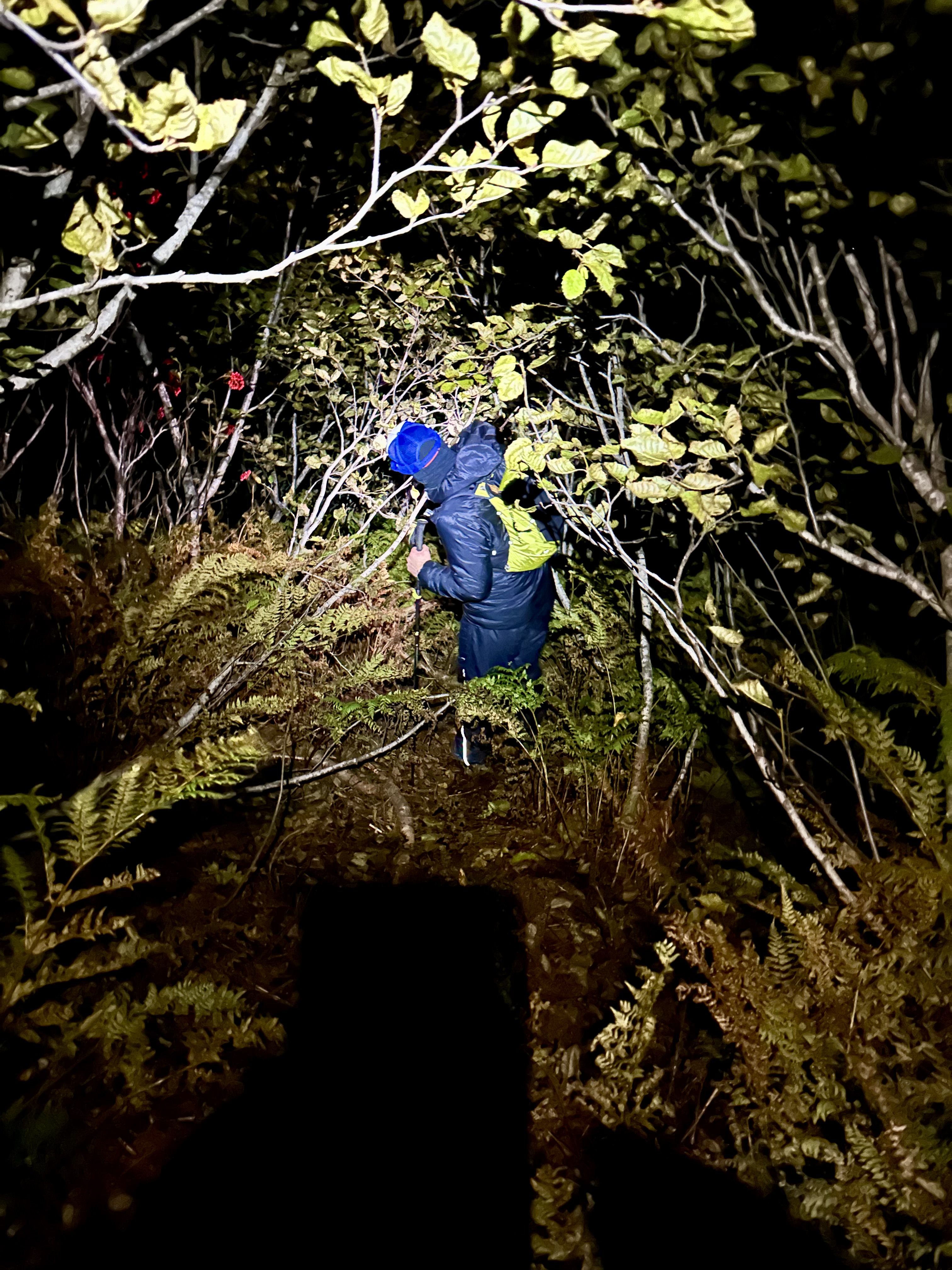
Numerous falls and crashes with the usual crawling, rolling, sliding and getting hit with branches. One could tell our patience and attitude was diminishing. We had been going continuously now for 19 hours. Can you say sufferfest, but still laughing.
Brandon was able to find with his wanderings what he thought was the old track where he had descended. Unfortunately it was going right through the alders. There was a vague resemblance to a trail which meant a little space in the alders, But it still was steep, muddy and slippery. We lost the trail numerous times, and alder bashing in the dark.
Finally we reached a vaguely more reasonable trail although it too was muddy and straight down and slippery. Numerous falls, none of which actually resulted in real injury. We descended and descended finally reaching a more reasonable slope but the trail went on seemingly forever. We were tired and ready to be done. Zak was waiting patiently in his car, at the Duck Pond trailhead. We reached a junction, and unsure of direction, took the direction Brandon remembered as correct. But after nearly a mile Zak called and said our tracker was going away from the parking lot and town. A bit of a debate as Brandon remember it from earlier trips as this was correct Alas we turned around and Zak came up the trail to meet us at 4:30 am. We arrived at the car at 5 am, 22 hours after beginning the hike, and 24 hours after the alarm had gone off to begin our prep and drive to the start. We were three tired puppies, including Zak who had stayed up all night in hopes of assisting us, more than just a great ride.
He drove us to my car and said he would take Brandon home. I could just go straight home and bed. The hallucinations began on the drive. Once I slammed on the brakes to avoid an elephant in the road. I turned on the 16 cameras in the car for extra eyes to monitor the road and driving. I arrived home Zak texting me to make sure I made it, at 6 am. But as I tried to get out of car, my body said no. My body seems to have been in continuous motion and now it was stopped it seized up. A very difficult climb up the stairs, into the shower, as would not be able to sleep with the dirt and smell, then a delightful 2 hour sleep awake at 8:45. Return to bed after breakfast and 2 more hours. Time to go into recovery mode as still seizing up and painful to just move in bed, let alone actually get up. Thus a day of forced labor moving about. (Well not exactly force, as one should never use force, just get a bigger hammer) I painfully mowed the lawn walking and working out the kinks. As with a mechanical piece which is stuck , you hammer it loose then work it until it is again smooth.
What did I learn? Sometimes your own backyard is the best place to vacation. Perhaps it is time for this body to get a big screen TV and start watching National Geographic videos. Just because one wants something does not mean you should get it. So many things to learn. I have read the brochure about being a smart person, a but apparently I do not have the requirements. Alas I can dream.

You are hard-core, if not a crazy old mam. I am glad you didn’t kill yourself!
LikeLiked by 1 person
oh I am paying for it. Still very sore and stiff and slow moving but working out the kinks and getting things done.
LikeLike
WOW! Just wow JR! What an incredible hike you did. Amazing. You might be feeling stiff, sore and exhausted but what sensational experience. Adventures like that remind us why we are alive and why we keep doing these crazy things. Love your positive attitude despite things not going quite to plan. Recover and I can’t wait to hear about the next one. Inspirational JR, truly inspirational.
LikeLiked by 1 person
At least you achieved what you set out to do.
LikeLiked by 1 person